ᱨᱮᱫ:Americas laea location map with borders.svg

Size of this PNG preview of this SVG file: ᱕᱓᱑ × ᱖᱐᱐ ᱯᱤᱠᱥᱮᱞ. ᱮᱴᱟᱜ ᱨᱤᱡᱚᱞᱩᱥᱚᱱᱥ: ᱒᱑᱒ × ᱒᱔᱐ ᱯᱤᱠᱥᱮᱞ | ᱔᱒᱕ × ᱔᱘᱐ ᱯᱤᱠᱥᱮᱞ | ᱖᱘᱐ × ᱗᱖᱘ ᱯᱤᱠᱥᱮᱞ | ᱙᱐᱖ × ᱑,᱐᱒᱔ ᱯᱤᱠᱥᱮᱞ | ᱑,᱘᱑᱒ × ᱒,᱐᱔᱘ ᱯᱤᱠᱥᱮᱞ | ᱒,᱖᱕᱕ × ᱓,᱐᱐᱐ ᱯᱤᱠᱥᱮᱞ
ᱟᱥᱚᱞ ᱨᱮᱫ (SVG ᱨᱮᱫ, ᱱᱚᱨᱢᱟᱞᱛᱮ ᱒,᱖᱕᱕ x ᱓,᱐᱐᱐ pixels, ᱨᱮᱫ ᱡᱟᱜᱟ: ᱑.᱖ MB)
ᱢᱩᱬᱩᱛ ᱠᱟᱛᱷᱟ
| ᱵᱤᱵᱚᱨᱚᱱᱤ |
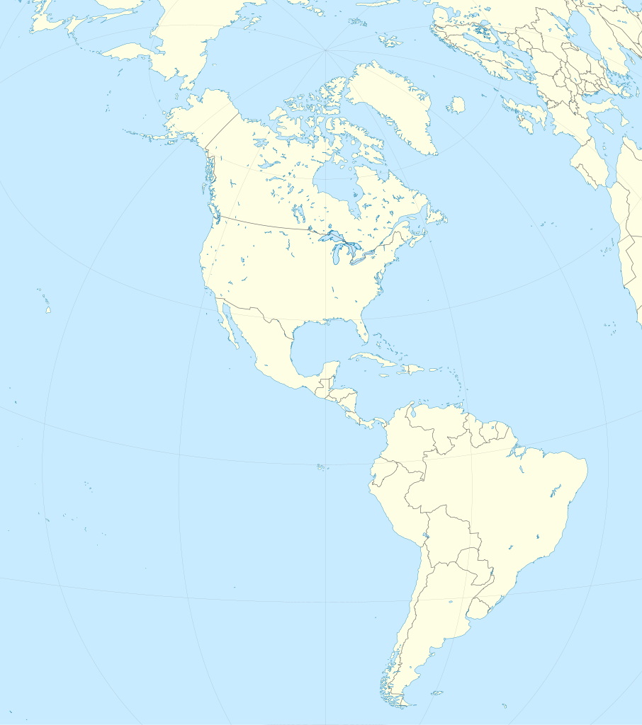
English: Location map of the Americas with political borders.
|
||
| ᱢᱟᱹᱦᱤᱛ | |||
| ᱯᱷᱮᱰᱟᱛ | ᱤᱧᱟᱜ ᱠᱟᱹᱢᱤ | ||
| ᱚᱱᱚᱞᱤᱭᱟᱹ |
TUBS |
||
| SVG genesis | This locator map was created with Adobe Illustrator by TUBS. This SVG locator map was uploaded with Commonist.
• (Credits to Alexrk2 who plotted natural earth data. Original svg provided by him is here) |

ᱞᱟᱭᱥᱮᱱᱥ ᱛᱮᱭᱟᱨ
I, the copyright holder of this work, hereby publish it under the following licenses:
ᱱᱚᱶᱟ ᱨᱮᱫ ᱫᱚ ᱥᱟᱫᱷᱟᱨᱚᱱ ᱥᱤᱨᱡᱟᱹᱣᱟᱜ Attribution-Share Alike 3.0 Unported ᱞᱟᱭᱥᱮᱸᱥ ᱛᱟᱹᱨᱤᱨᱮ ᱢᱮᱱᱟᱜ-ᱟ ᱾
- ᱟᱲᱟᱜ ᱜᱮᱭᱟᱢ:
- ᱦᱟᱹᱴᱤᱧᱢᱮ – ᱱᱚᱠᱚᱞ ᱞᱟᱹᱜᱤᱫ, ᱦᱟᱹᱴᱤᱧ ᱟᱨ ᱵᱷᱮᱡᱟᱭᱢᱮ ᱠᱟᱹᱢᱤ
- ᱢᱮᱥᱟᱣᱠᱟᱛᱢᱮ – ᱠᱟᱹᱢᱤ ᱟᱞᱜᱟᱭ ᱞᱟᱹᱜᱤᱫ
- ᱞᱟᱛᱟᱨ ᱨᱮᱭᱟᱜ ᱨᱤᱛ ᱞᱮᱠᱟᱛᱮ:
- ᱟᱴᱨᱤᱵᱩᱥᱚᱱ – ᱟᱢ ᱠᱟᱹᱢᱤ ᱥᱚᱫᱚᱨ ᱦᱩᱭᱟᱢᱟ ᱡᱚᱠᱷᱚᱱ ᱚᱱᱚᱞᱤᱭᱟᱹ ᱟᱨᱵᱟᱝ ᱞᱟᱭᱥᱮᱸᱥᱩᱭᱟᱹ ᱫᱟᱨᱟᱭᱛᱮ ᱠᱟᱛᱷᱟ ᱨᱟᱠᱟᱵ ᱠᱷᱟᱱ (ᱢᱮᱱᱠᱷᱟᱱ ᱟᱠᱚ ᱩᱫᱩᱜᱟᱜ ᱦᱚᱨ ᱛᱮᱫᱚ ᱵᱟᱝ ᱡᱟᱦᱟᱸ ᱟᱠᱚᱠᱚ ᱜᱚᱲᱚᱣᱟᱢ ᱟᱨᱵᱟᱝ ᱟᱢᱟᱜ ᱠᱟᱹᱢᱤ ᱨᱮᱱᱟᱜ ᱵᱮᱵᱷᱟᱨ)
- ᱦᱟᱹᱴᱤᱧ ᱱᱚᱝᱠᱟ ᱜᱮ – ᱟᱢ ᱡᱩᱫᱤ ᱠᱟᱹᱢᱤ ᱵᱚᱫᱚᱞ, ᱛᱚᱨᱡᱚᱢᱟ, ᱵᱟᱝᱠᱷᱟᱱ ᱱᱚᱣᱟ ᱠᱟᱹᱢᱤ ᱪᱮᱛᱟᱱᱨᱮ ᱱᱟᱣᱟ ᱠᱟᱹᱢᱤ ᱥᱤᱨᱡᱟᱹᱣᱮᱢ ᱛᱮᱭᱟᱨ ᱠᱷᱟᱱ, ᱛᱚᱵᱮ ᱟᱢ ᱫᱚ ᱚᱱᱟ ᱠᱟᱹᱢᱤ ᱚᱱᱟ ᱢᱤᱫ ᱞᱟᱤᱥᱮᱱᱥ ᱥᱮ ᱚᱱᱟ ᱞᱮᱠᱟᱱᱟᱜ ᱞᱟᱤᱥᱮᱱᱥ ᱨᱮᱜᱮ ᱪᱟᱞ ᱦᱩᱭᱩᱜ ᱛᱟᱢᱟ᱾

|
ᱫᱟᱣ ᱮᱢᱮᱱᱟ ᱱᱚᱠᱚᱞ, ᱦᱟᱹᱴᱤᱧ ᱟᱨ/ᱟᱨᱵᱟᱝ ᱟᱹᱨᱩᱯᱷᱮᱨᱟᱣ ᱞᱟᱹᱜᱤᱫ ᱱᱚᱶᱟ ᱱᱩᱛᱷᱤ ᱠᱚ GNU Free Documentation License ᱟᱹᱨᱤ ᱛᱮ, ᱵᱷᱟᱨᱥᱚᱱ ᱑.᱒ ᱟᱨᱵᱟᱝ ᱡᱟᱦᱟᱸᱜᱮ ᱛᱟᱭᱚᱢᱟᱜ ᱵᱷᱟᱨᱥᱚᱱ Free Software Foundation ᱫᱟᱨᱟᱭᱛᱮ ᱩᱪᱷᱟᱹᱱ ᱟᱠᱟᱱ; ᱵᱤᱱ ᱵᱷᱮᱯᱮᱜᱮᱫ ᱦᱟᱹᱴᱤᱧ, ᱵᱤᱱ ᱥᱟᱢᱟᱝ ᱚᱞᱠᱚ, ᱟᱨ ᱵᱤᱱ ᱯᱟᱹᱪᱷᱞᱟᱹ ᱚᱞᱠᱚ ᱥᱟᱶᱛᱮ ᱾ ᱢᱤᱫ GNU Free Documentation License ᱧᱩᱛᱩᱢᱟᱱ ᱞᱟᱭᱥᱮᱸᱥ ᱨᱮᱱᱟᱜ ᱱᱚᱠᱚᱞ ᱡᱚᱲᱟᱣᱮᱱᱟ ᱾ |
ᱟᱢᱟᱜ ᱠᱩᱥᱤ ᱞᱮᱠᱟᱛᱮ ᱞᱟᱭᱥᱮᱱᱥ ᱵᱟᱪᱷᱟᱣ ᱫᱟᱲᱮᱭᱟᱜ ᱟᱢ᱾

|
I'd greatly appreciate, that you attribute this media file to Wikimedia Commons, if used outside Wikipedia or Commons. For use in publications such as books, newspapers, blogs, websites, please insert here the following line:
|
ᱨᱮᱫ ᱨᱮᱭᱟᱜ ᱱᱟᱜᱟᱢ
ᱚᱠᱛᱚ ᱨᱮ ᱞᱤᱱ ᱢᱮ/ᱚᱠᱛᱚ ᱨᱮ ᱨᱮᱫ ᱧᱮᱞ ᱞᱟᱹᱜᱤᱛ ᱞᱤᱱ ᱢᱮ
| ᱢᱟᱹᱦᱤᱛ/ᱚᱠᱛᱚ | ᱴᱤᱯ | ᱡᱚᱠᱷᱟ | ᱵᱮᱵᱷᱟᱨᱤᱭᱟᱹ | ᱠᱟᱛᱷᱟ | |
|---|---|---|---|---|---|
| ᱱᱤᱛᱚᱜ | ᱑᱔:᱐᱙, ᱑᱔ ᱡᱩᱞᱟᱭ ᱒᱐᱑᱒ | | ᱒,᱖᱕᱕ × ᱓,᱐᱐᱐ (᱑.᱖ MB) | TUBS | {{Information |Description={{en|1= Location map of the Americas. * Projection: Lambert azimuthal equal-area projection. * Area of interest: :* N: X.X° N :* S: -X.X° S :* W: -X.X° E :* E: -X.X° E * Projection center: :* NS: 20.0° N :* WE: 90° W * ... |
ᱯᱷᱟᱭᱤᱞ ᱵᱮᱣᱦᱟᱨ
ᱞᱟᱛᱟᱨ ᱨᱮᱭᱟᱜ 3 ᱥᱟᱦᱴᱟᱠᱚ ᱡᱚᱱᱚᱲ ᱱᱤᱭᱟᱹ ᱨᱮᱫ ᱨᱮ:
ᱡᱮᱜᱮᱛ ᱡᱟᱠᱟᱛ ᱨᱮᱫ ᱵᱮᱵᱷᱟᱨᱟᱜ
ᱱᱚᱶᱟ ᱨᱮᱫᱠᱚ ᱵᱮᱵᱷᱟᱨᱟᱠᱟᱫ ᱣᱤᱠᱤᱠᱚ :
- ar.wikipedia.org ᱨᱮ ᱵᱮᱣᱦᱟᱨ
- ast.wikipedia.org ᱨᱮ ᱵᱮᱣᱦᱟᱨ
- ca.wikipedia.org ᱨᱮ ᱵᱮᱣᱦᱟᱨ
- ceb.wikipedia.org ᱨᱮ ᱵᱮᱣᱦᱟᱨ
- de.wikipedia.org ᱨᱮ ᱵᱮᱣᱦᱟᱨ
- en.wikipedia.org ᱨᱮ ᱵᱮᱣᱦᱟᱨ
- Guatemala City
- Panama City
- Bogotá
- 2004 Summer Olympics torch relay
- Battle of Boyacá
- Battle of Angamos
- Battle of Carabobo
- Battle of Ayacucho
- Battle of Cajamarca
- Johan Adolf Pengel International Airport
- Battle of Las Salinas
- Talk:International Football Association Board
- Battle of Lake Maracaibo
- Battle of Cusco
- Wet 'n Wild (brand)
- Battle of Topáter
- Battle of Pisagua
- Battle of San Francisco
- Battle of Suipacha
- Battle of Viluma
- Battle of Vilcapugio
- Battle of Ayohuma
- Battle of La Concepción
- Battle of Ingavi
- Battle of Tacna
- Battle of Cotagaita
- Battle of Yavi
- Battle of Salta
- Battle of Tucumán
- Battle of Pequereque
- Action of Tambo Nuevo
- Parapan American Games
- Arctotherium
- Campo Vía pocket
- Battle of Gondra
- Battle of Kilometer 7
- Battle of la Tablada de Tolomosa
- Module:Location map/data/America/doc
- Battle of Iquique
- Second Battle of Nanawa
- First Battle of Nanawa
- Battle of Boquerón (1932)
ᱱᱚᱶᱟ ᱨᱮᱫ ᱨᱮᱱᱟᱜ ᱵᱟᱹᱲᱛᱤ ᱡᱮᱜᱮᱛ ᱵᱮᱵᱷᱟᱨ ᱧᱮᱞ ᱢᱮ ᱾