ᱨᱮᱫ:Armenia adm location map.svg

ᱟᱥᱚᱞ ᱨᱮᱫ (SVG ᱨᱮᱫ, ᱱᱚᱨᱢᱟᱞᱛᱮ ᱑,᱑᱖᱙ x ᱑,᱑᱙᱘ pixels, ᱨᱮᱫ ᱡᱟᱜᱟ: ᱑᱔᱖ KB)
ᱢᱩᱬᱩᱛ ᱠᱟᱛᱷᱟ
| ᱵᱤᱵᱚᱨᱚᱱᱤ |
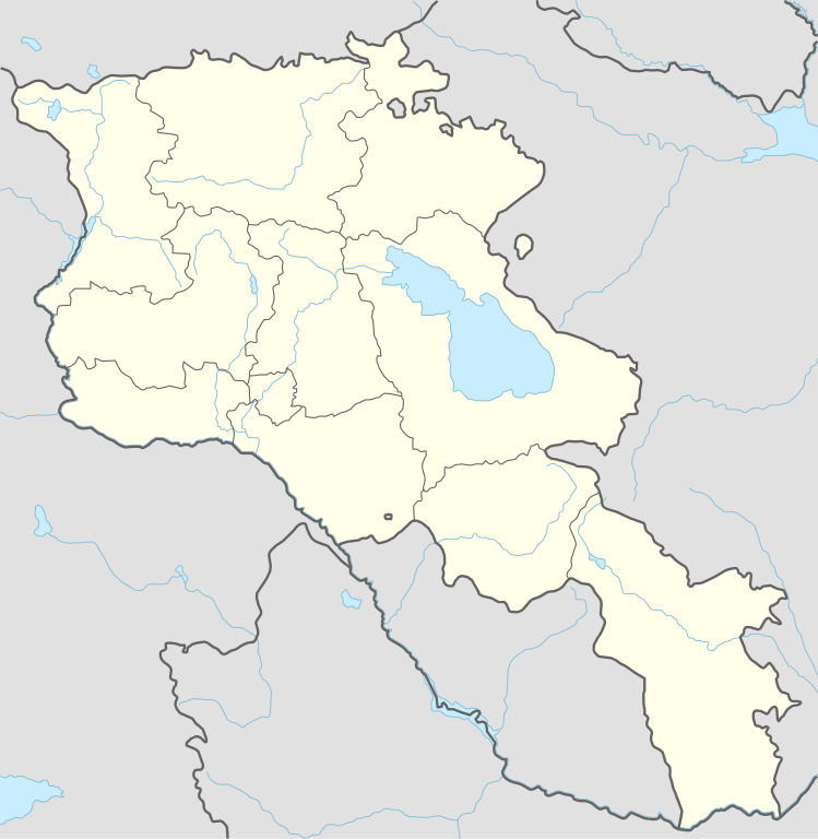
Deutsch: Positionskarte von Armenien
English: Location map of Armenia
|
||||||||||||
| ᱢᱟᱹᱦᱤᱛ | |||||||||||||
| ᱯᱷᱮᱰᱟᱛ |
Own work using:
|
||||||||||||
| ᱚᱱᱚᱞᱤᱭᱟᱹ | NordNordWest | ||||||||||||

|
This map has been made or improved in the German Kartenwerkstatt (Map Lab). You can propose maps to improve as well.
|
ᱞᱟᱭᱥᱮᱱᱥ ᱛᱮᱭᱟᱨ
Usage of this file with:

explanatory notes: Legally binding is only the full legalcode. For a free usage I recommend to respect the following licence conditions:
1. Provide my name as given above: NordNordWest,
2. a copy of, or the URI for, the applicable license: https://creativecommons.org/licenses/by-sa/3.0/de/legalcode,
3. the title of the work,
4. in the case of an adaptation, a credit identifying the use of the work in the adaptation.
This license and the rights granted hereunder will terminate automatically upon any breach by you of the terms of this license. Any of the above conditions can be waived if you get permission from the copyright holder. If you have questions or wish differing conditions, please contact me through nnwest or my discussion page ![]() t-online.de
t-online.de
- ᱟᱲᱟᱜ ᱜᱮᱭᱟᱢ:
- ᱦᱟᱹᱴᱤᱧᱢᱮ – ᱱᱚᱠᱚᱞ ᱞᱟᱹᱜᱤᱫ, ᱦᱟᱹᱴᱤᱧ ᱟᱨ ᱵᱷᱮᱡᱟᱭᱢᱮ ᱠᱟᱹᱢᱤ
- ᱢᱮᱥᱟᱣᱠᱟᱛᱢᱮ – ᱠᱟᱹᱢᱤ ᱟᱞᱜᱟᱭ ᱞᱟᱹᱜᱤᱫ
- ᱞᱟᱛᱟᱨ ᱨᱮᱭᱟᱜ ᱨᱤᱛ ᱞᱮᱠᱟᱛᱮ:
- ᱟᱴᱨᱤᱵᱩᱥᱚᱱ – ᱟᱢ ᱠᱟᱹᱢᱤ ᱥᱚᱫᱚᱨ ᱦᱩᱭᱟᱢᱟ ᱡᱚᱠᱷᱚᱱ ᱚᱱᱚᱞᱤᱭᱟᱹ ᱟᱨᱵᱟᱝ ᱞᱟᱭᱥᱮᱸᱥᱩᱭᱟᱹ ᱫᱟᱨᱟᱭᱛᱮ ᱠᱟᱛᱷᱟ ᱨᱟᱠᱟᱵ ᱠᱷᱟᱱ (ᱢᱮᱱᱠᱷᱟᱱ ᱟᱠᱚ ᱩᱫᱩᱜᱟᱜ ᱦᱚᱨ ᱛᱮᱫᱚ ᱵᱟᱝ ᱡᱟᱦᱟᱸ ᱟᱠᱚᱠᱚ ᱜᱚᱲᱚᱣᱟᱢ ᱟᱨᱵᱟᱝ ᱟᱢᱟᱜ ᱠᱟᱹᱢᱤ ᱨᱮᱱᱟᱜ ᱵᱮᱵᱷᱟᱨ)
- ᱦᱟᱹᱴᱤᱧ ᱱᱚᱝᱠᱟ ᱜᱮ – ᱟᱢ ᱡᱩᱫᱤ ᱠᱟᱹᱢᱤ ᱵᱚᱫᱚᱞ, ᱛᱚᱨᱡᱚᱢᱟ, ᱵᱟᱝᱠᱷᱟᱱ ᱱᱚᱣᱟ ᱠᱟᱹᱢᱤ ᱪᱮᱛᱟᱱᱨᱮ ᱱᱟᱣᱟ ᱠᱟᱹᱢᱤ ᱥᱤᱨᱡᱟᱹᱣᱮᱢ ᱛᱮᱭᱟᱨ ᱠᱷᱟᱱ, ᱛᱚᱵᱮ ᱟᱢ ᱫᱚ ᱚᱱᱟ ᱠᱟᱹᱢᱤ ᱚᱱᱟ ᱢᱤᱫ ᱞᱟᱤᱥᱮᱱᱥ ᱥᱮ ᱚᱱᱟ ᱞᱮᱠᱟᱱᱟᱜ ᱞᱟᱤᱥᱮᱱᱥ ᱨᱮᱜᱮ ᱪᱟᱞ ᱦᱩᱭᱩᱜ ᱛᱟᱢᱟ᱾

ᱨᱮᱫ ᱨᱮᱭᱟᱜ ᱱᱟᱜᱟᱢ
ᱚᱠᱛᱚ ᱨᱮ ᱞᱤᱱ ᱢᱮ/ᱚᱠᱛᱚ ᱨᱮ ᱨᱮᱫ ᱧᱮᱞ ᱞᱟᱹᱜᱤᱛ ᱞᱤᱱ ᱢᱮ
| ᱢᱟᱹᱦᱤᱛ/ᱚᱠᱛᱚ | ᱴᱤᱯ | ᱡᱚᱠᱷᱟ | ᱵᱮᱵᱷᱟᱨᱤᱭᱟᱹ | ᱠᱟᱛᱷᱟ | |
|---|---|---|---|---|---|
| ᱱᱤᱛᱚᱜ | ᱑᱘:᱓᱖, ᱒᱐ ᱱᱚᱵᱷᱮᱢᱵᱚᱨ ᱒᱐᱒᱓ | | ᱑,᱑᱖᱙ × ᱑,᱑᱙᱘ (᱑᱔᱖ KB) | NordNordWest | back to original size |
| ᱑᱐:᱓᱔, ᱒᱐ ᱱᱚᱵᱷᱮᱢᱵᱚᱨ ᱒᱐᱒᱓ |  | ᱕᱑᱒ × ᱕᱒᱔ (᱑᱓᱐ KB) | Toghrul R | updated | |
| ᱐᱙:᱓᱒, ᱒᱐ ᱡᱟᱱᱩᱣᱟᱨᱤ ᱒᱐᱒᱓ |  | ᱑,᱑᱖᱙ × ᱑,᱑᱙᱘ (᱑᱕᱒ KB) | Golden | updating NK borders - no control in the south, removing old Lachin corridor | |
| ᱑᱗:᱐᱖, ᱑᱔ ᱱᱚᱵᱷᱮᱢᱵᱚᱨ ᱒᱐᱒᱐ |  | ᱑,᱑᱖᱙ × ᱑,᱑᱙᱘ (᱑᱕᱐ KB) | NordNordWest | . | |
| ᱒᱐:᱕᱘, ᱒᱑ ᱚᱠᱴᱚᱵᱚᱨ ᱒᱐᱑᱔ |  | ᱑,᱑᱖᱙ × ᱑,᱑᱙᱘ (᱑᱖᱑ KB) | NordNordWest | == {{int:filedesc}} == {{Information |Description= {{de|1=Positionskarte von Armenien}} {{en|1=Location map of Armenia}} {{Location map series N |stretching=130 |top=41.4 |bottom=38.8 |left=43.4 |right=46.7 }} |Source={{Own using}} * United States Nati... |
ᱯᱷᱟᱭᱤᱞ ᱵᱮᱣᱦᱟᱨ
ᱞᱟᱛᱟᱨ ᱨᱮᱭᱟᱜ 2 ᱥᱟᱦᱴᱟᱠᱚ ᱡᱚᱱᱚᱲ ᱱᱤᱭᱟᱹ ᱨᱮᱫ ᱨᱮ:
ᱡᱮᱜᱮᱛ ᱡᱟᱠᱟᱛ ᱨᱮᱫ ᱵᱮᱵᱷᱟᱨᱟᱜ
ᱱᱚᱶᱟ ᱨᱮᱫᱠᱚ ᱵᱮᱵᱷᱟᱨᱟᱠᱟᱫ ᱣᱤᱠᱤᱠᱚ :
- af.wikipedia.org ᱨᱮ ᱵᱮᱣᱦᱟᱨ
- als.wikipedia.org ᱨᱮ ᱵᱮᱣᱦᱟᱨ
- an.wikipedia.org ᱨᱮ ᱵᱮᱣᱦᱟᱨ
- ar.wikipedia.org ᱨᱮ ᱵᱮᱣᱦᱟᱨ
- ast.wikipedia.org ᱨᱮ ᱵᱮᱣᱦᱟᱨ
- Yeghipatrush
- Yereván
- Castiellu d'Erebuni
- Fortaleza d'Ertij
- Fortaleza de Kosh
- Lori Berd
- Ciudadela d'Horom
- Castiellu de Bjni
- Vorotnaberd
- Fortaleza Ajtala
- Amberd
- Baghaberd
- Castiellu de Yereván
- Berdkunk
- Fortaleza Berdavan
- Fortaleza Berdkunk
- Proshaberd
- Fortaleza Dashtadem
- Kakavaberd
- Fortaleza Halidzor
- Karmir Blur
- Sardari Berd
- Sev Berd
- Smbataberd
- Fuerte Tavush
- Teishebaini
- Yergevanits
- Ushiberd
- Tsitsernakaberd
- Echmiadzin
- Yerevandashat (ciudá antigua)
- Dvin
- Hnaberd (Aragatsotn)
- Argishtikhinili
- Fortaleza de Meghri
- Armavir (ciudá antigua)
- Módulu:Mapa de llocalización/datos/Armenia
- Módulu:Mapa de llocalización/datos/Armenia/usu
- Guiumri
- Bancu Central d'Armenia
- Yeghegnadzor
ᱱᱚᱶᱟ ᱨᱮᱫ ᱨᱮᱱᱟᱜ ᱵᱟᱹᱲᱛᱤ ᱡᱮᱜᱮᱛ ᱵᱮᱵᱷᱟᱨ ᱧᱮᱞ ᱢᱮ ᱾