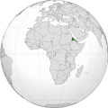
ᱨᱮᱫ:Eritrea (Africa orthographic projection).svg

Size of this PNG preview of this SVG file: ᱕᱕᱐ × ᱕᱕᱐ ᱯᱤᱠᱥᱮᱞ. ᱮᱴᱟᱜ ᱨᱤᱡᱚᱞᱩᱥᱚᱱᱥ: ᱒᱔᱐ × ᱒᱔᱐ ᱯᱤᱠᱥᱮᱞ | ᱔᱘᱐ × ᱔᱘᱐ ᱯᱤᱠᱥᱮᱞ | ᱗᱖᱘ × ᱗᱖᱘ ᱯᱤᱠᱥᱮᱞ | ᱑,᱐᱒᱔ × ᱑,᱐᱒᱔ ᱯᱤᱠᱥᱮᱞ | ᱒,᱐᱔᱘ × ᱒,᱐᱔᱘ ᱯᱤᱠᱥᱮᱞ
ᱟᱥᱚᱞ ᱨᱮᱫ (SVG ᱨᱮᱫ, ᱱᱚᱨᱢᱟᱞᱛᱮ ᱕᱕᱐ x ᱕᱕᱐ pixels, ᱨᱮᱫ ᱡᱟᱜᱟ: ᱑᱔᱑ KB)
ᱨᱮᱫ ᱨᱮᱭᱟᱜ ᱱᱟᱜᱟᱢ
ᱚᱠᱛᱚ ᱨᱮ ᱞᱤᱱ ᱢᱮ/ᱚᱠᱛᱚ ᱨᱮ ᱨᱮᱫ ᱧᱮᱞ ᱞᱟᱹᱜᱤᱛ ᱞᱤᱱ ᱢᱮ
| ᱢᱟᱹᱦᱤᱛ/ᱚᱠᱛᱚ | ᱴᱤᱯ | ᱡᱚᱠᱷᱟ | ᱵᱮᱵᱷᱟᱨᱤᱭᱟᱹ | ᱠᱟᱛᱷᱟ | |
|---|---|---|---|---|---|
| ᱱᱤᱛᱚᱜ | ᱐᱘:᱕᱕, ᱙ ᱮᱯᱨᱤᱞ ᱒᱐᱑᱘ |  | ᱕᱕᱐ × ᱕᱕᱐ (᱑᱔᱑ KB) | Nikki070 | Reverted to version as of 20:28, 16 December 2012 (UTC); unification |
| ᱑᱙:᱓᱗, ᱑᱗ ᱢᱟᱨᱪ ᱒᱐᱑᱗ |  | ᱕᱕᱐ × ᱕᱕᱐ (᱑᱘᱕ KB) | Esmu Igors | Colors from the locator map of France don't seem to have enough contrast; I therefore made Africa on the map darker. | |
| ᱑᱙:᱓᱔, ᱑᱗ ᱢᱟᱨᱪ ᱒᱐᱑᱗ |  | ᱕᱕᱐ × ᱕᱕᱐ (᱑᱘᱕ KB) | Esmu Igors | Description, at least on the en.wikipedia.org article "Eritrea" has description about Africa dark grey and the rest of the world gray. I didn't see any of this, so changed the colours as were in an analogous map for France. | |
| ᱐᱘:᱓᱗, ᱑᱕ ᱢᱮ ᱒᱐᱑᱖ |  | ᱕᱕᱐ × ᱕᱕᱐ (᱑᱘᱖ KB) | Richard0048 | Reverted to version as of 20:52, 14 May 2016 (UTC) | |
| ᱐᱘:᱑᱕, ᱑᱕ ᱢᱮ ᱒᱐᱑᱖ |  | ᱕᱕᱐ × ᱕᱕᱐ (᱑᱘᱖ KB) | Richard0048 | Col | |
| ᱒᱐:᱕᱒, ᱑᱔ ᱢᱮ ᱒᱐᱑᱖ |  | ᱕᱕᱐ × ᱕᱕᱐ (᱑᱘᱖ KB) | Richard0048 | clearer borders | |
| ᱒᱐:᱔᱙, ᱑᱔ ᱢᱮ ᱒᱐᱑᱖ |  | ᱕᱕᱐ × ᱕᱕᱐ (᱑᱘᱖ KB) | Richard0048 | Reverted to version as of 16:51, 13 December 2012 (UTC) | |
| ᱒᱐:᱒᱘, ᱑᱖ ᱰᱤᱥᱮᱢᱵᱚᱨ ᱒᱐᱑᱒ |  | ᱕᱕᱐ × ᱕᱕᱐ (᱑᱔᱑ KB) | Sémhur | Light grey version ; prominent Congo river removed | |
| ᱑᱖:᱕᱑, ᱑᱓ ᱰᱤᱥᱮᱢᱵᱚᱨ ᱒᱐᱑᱒ |  | ᱕᱕᱐ × ᱕᱕᱐ (᱑᱘᱖ KB) | Chipmunkdavis | Version with colours that greatly contrast, with South Sudan border and other fixes | |
| ᱐᱙:᱓᱔, ᱑᱓ ᱰᱤᱥᱮᱢᱵᱚᱨ ᱒᱐᱑᱒ |  | ᱕᱕᱐ × ᱕᱕᱐ (᱑᱔᱒ KB) | Sémhur | That's your pov, not mine, but please do not destroy informations! (south sudan border and few corrections) |
ᱯᱷᱟᱭᱤᱞ ᱵᱮᱣᱦᱟᱨ
ᱞᱟᱛᱟᱨ ᱨᱮᱭᱟᱜ ᱥᱟᱦᱴᱟ ᱡᱚᱱᱚᱲᱠᱚ ᱱᱤᱭᱟᱹ ᱨᱮᱫ ᱨᱮ:
ᱡᱮᱜᱮᱛ ᱡᱟᱠᱟᱛ ᱨᱮᱫ ᱵᱮᱵᱷᱟᱨᱟᱜ
ᱱᱚᱶᱟ ᱨᱮᱫᱠᱚ ᱵᱮᱵᱷᱟᱨᱟᱠᱟᱫ ᱣᱤᱠᱤᱠᱚ :
- ami.wikipedia.org ᱨᱮ ᱵᱮᱣᱦᱟᱨ
- ar.wikipedia.org ᱨᱮ ᱵᱮᱣᱦᱟᱨ
- arz.wikipedia.org ᱨᱮ ᱵᱮᱣᱦᱟᱨ
- avk.wikipedia.org ᱨᱮ ᱵᱮᱣᱦᱟᱨ
- azb.wikipedia.org ᱨᱮ ᱵᱮᱣᱦᱟᱨ
- az.wiktionary.org ᱨᱮ ᱵᱮᱣᱦᱟᱨ
- be-tarask.wikipedia.org ᱨᱮ ᱵᱮᱣᱦᱟᱨ
- bg.wikipedia.org ᱨᱮ ᱵᱮᱣᱦᱟᱨ
- bh.wikipedia.org ᱨᱮ ᱵᱮᱣᱦᱟᱨ
- bi.wikipedia.org ᱨᱮ ᱵᱮᱣᱦᱟᱨ
- ca.wikipedia.org ᱨᱮ ᱵᱮᱣᱦᱟᱨ
- ceb.wikipedia.org ᱨᱮ ᱵᱮᱣᱦᱟᱨ
- ckb.wikipedia.org ᱨᱮ ᱵᱮᱣᱦᱟᱨ
- cs.wikipedia.org ᱨᱮ ᱵᱮᱣᱦᱟᱨ
- cu.wikipedia.org ᱨᱮ ᱵᱮᱣᱦᱟᱨ
- da.wikipedia.org ᱨᱮ ᱵᱮᱣᱦᱟᱨ
- de.wikivoyage.org ᱨᱮ ᱵᱮᱣᱦᱟᱨ
- din.wikipedia.org ᱨᱮ ᱵᱮᱣᱦᱟᱨ
- dv.wikipedia.org ᱨᱮ ᱵᱮᱣᱦᱟᱨ
- el.wikipedia.org ᱨᱮ ᱵᱮᱣᱦᱟᱨ
- en.wikipedia.org ᱨᱮ ᱵᱮᱣᱦᱟᱨ
- en.wikinews.org ᱨᱮ ᱵᱮᱣᱦᱟᱨ
- en.wikivoyage.org ᱨᱮ ᱵᱮᱣᱦᱟᱨ
- eo.wikipedia.org ᱨᱮ ᱵᱮᱣᱦᱟᱨ
- es.wikipedia.org ᱨᱮ ᱵᱮᱣᱦᱟᱨ
- eu.wikipedia.org ᱨᱮ ᱵᱮᱣᱦᱟᱨ
- fa.wikipedia.org ᱨᱮ ᱵᱮᱣᱦᱟᱨ
- ff.wikipedia.org ᱨᱮ ᱵᱮᱣᱦᱟᱨ
- fi.wikipedia.org ᱨᱮ ᱵᱮᱣᱦᱟᱨ
- fr.wikipedia.org ᱨᱮ ᱵᱮᱣᱦᱟᱨ
- fr.wikinews.org ᱨᱮ ᱵᱮᱣᱦᱟᱨ
- gl.wikipedia.org ᱨᱮ ᱵᱮᱣᱦᱟᱨ
- ha.wikipedia.org ᱨᱮ ᱵᱮᱣᱦᱟᱨ
- he.wikipedia.org ᱨᱮ ᱵᱮᱣᱦᱟᱨ
- hr.wikipedia.org ᱨᱮ ᱵᱮᱣᱦᱟᱨ
ᱱᱚᱶᱟ ᱨᱮᱫ ᱨᱮᱱᱟᱜ ᱵᱟᱹᱲᱛᱤ ᱡᱮᱜᱮᱛ ᱵᱮᱵᱷᱟᱨ ᱧᱮᱞ ᱢᱮ ᱾