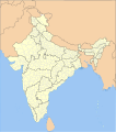
ᱨᱮᱫ:India district map (de-facto).svg

Size of this PNG preview of this SVG file: ᱕᱕᱗ × ᱖᱐᱐ ᱯᱤᱠᱥᱮᱞ. ᱮᱴᱟᱜ ᱨᱤᱡᱚᱞᱩᱥᱚᱱᱥ: ᱒᱒᱓ × ᱒᱔᱐ ᱯᱤᱠᱥᱮᱞ | ᱔᱔᱖ × ᱔᱘᱐ ᱯᱤᱠᱥᱮᱞ | ᱗᱑᱓ × ᱗᱖᱘ ᱯᱤᱠᱥᱮᱞ | ᱙᱕᱑ × ᱑,᱐᱒᱔ ᱯᱤᱠᱥᱮᱞ | ᱑,᱙᱐᱒ × ᱒,᱐᱔᱘ ᱯᱤᱠᱥᱮᱞ | ᱑,᱕᱐᱐ × ᱑,᱖᱑᱕ ᱯᱤᱠᱥᱮᱞ
ᱟᱥᱚᱞ ᱨᱮᱫ (SVG ᱨᱮᱫ, ᱱᱚᱨᱢᱟᱞᱛᱮ ᱑,᱕᱐᱐ x ᱑,᱖᱑᱕ pixels, ᱨᱮᱫ ᱡᱟᱜᱟ: ᱓.᱑ MB)
ᱨᱮᱫ ᱨᱮᱭᱟᱜ ᱱᱟᱜᱟᱢ
ᱚᱠᱛᱚ ᱨᱮ ᱞᱤᱱ ᱢᱮ/ᱚᱠᱛᱚ ᱨᱮ ᱨᱮᱫ ᱧᱮᱞ ᱞᱟᱹᱜᱤᱛ ᱞᱤᱱ ᱢᱮ
| ᱢᱟᱹᱦᱤᱛ/ᱚᱠᱛᱚ | ᱴᱤᱯ | ᱡᱚᱠᱷᱟ | ᱵᱮᱵᱷᱟᱨᱤᱭᱟᱹ | ᱠᱟᱛᱷᱟ | |
|---|---|---|---|---|---|
| ᱱᱤᱛᱚᱜ | ᱐᱕:᱑᱘, ᱒ ᱢᱮ ᱒᱐᱒᱒ |  | ᱑,᱕᱐᱐ × ᱑,᱖᱑᱕ (᱓.᱑ MB) | C1MM | Updated to 2022 |
| ᱑᱖:᱔᱖, ᱖ ᱯᱷᱮᱵᱽᱨᱩᱣᱟᱨᱤ ᱒᱐᱒᱒ |  | ᱑,᱖᱔᱓ × ᱑,᱘᱕᱖ (᱑.᱘᱘ MB) | Milenioscuro | standard colors | |
| ᱐᱔:᱓᱔, ᱒᱒ ᱥᱮᱯᱴᱮᱢᱵᱚᱨ ᱒᱐᱒᱑ |  | ᱑,᱖᱔᱓ × ᱑,᱘᱕᱖ (᱑.᱘᱘ MB) | C1MM | Removed duplicate districts | |
| ᱐᱔:᱐᱙, ᱒᱒ ᱥᱮᱯᱴᱮᱢᱵᱚᱨ ᱒᱐᱒᱑ |  | ᱑,᱖᱔᱓ × ᱑,᱘᱕᱖ (᱑.᱘᱙ MB) | C1MM | Added far more accurate district boundaries | |
| ᱒᱐:᱒᱓, ᱑᱖ ᱯᱷᱮᱵᱽᱨᱩᱣᱟᱨᱤ ᱒᱐᱒᱑ |  | ᱑,᱖᱔᱓ × ᱑,᱘᱕᱖ (᱒ MB) | C1MM | Added better district boundaries | |
| ᱐᱖:᱐᱐, ᱑᱓ ᱱᱚᱵᱷᱮᱢᱵᱚᱨ ᱒᱐᱒᱐ |  | ᱑,᱖᱔᱓ × ᱑,᱘᱕᱖ (᱑.᱙ MB) | C1MM | Updated shapefiles, made district boundaries more accurate | |
| ᱒᱑:᱐᱐, ᱒᱕ ᱡᱩᱞᱟᱭ ᱒᱐᱒᱐ |  | ᱑,᱖᱔᱓ × ᱑,᱘᱕᱖ (᱑.᱖᱕ MB) | C1MM | Fixed state and intl border colours | |
| ᱐᱕:᱐᱐, ᱒᱕ ᱡᱩᱞᱟᱭ ᱒᱐᱒᱐ |  | ᱑,᱖᱔᱓ × ᱑,᱘᱕᱖ (᱑.᱖᱔ MB) | C1MM | Reformatted for easier use, updated district map to situation as of July 2020 | |
| ᱒᱐:᱓᱔, ᱑᱕ ᱢᱟᱨᱪ ᱒᱐᱑᱗ |  | ᱑,᱖᱔᱓ × ᱑,᱘᱕᱖ (᱘᱐᱐ KB) | Superbenjamin | User created page with UploadWizard |
ᱯᱷᱟᱭᱤᱞ ᱵᱮᱣᱦᱟᱨ
ᱞᱟᱛᱟᱨ ᱨᱮᱭᱟᱜ ᱥᱟᱦᱴᱟ ᱡᱚᱱᱚᱲᱠᱚ ᱱᱤᱭᱟᱹ ᱨᱮᱫ ᱨᱮ:
ᱡᱮᱜᱮᱛ ᱡᱟᱠᱟᱛ ᱨᱮᱫ ᱵᱮᱵᱷᱟᱨᱟᱜ
ᱱᱚᱶᱟ ᱨᱮᱫᱠᱚ ᱵᱮᱵᱷᱟᱨᱟᱠᱟᱫ ᱣᱤᱠᱤᱠᱚ :
- anp.wikipedia.org ᱨᱮ ᱵᱮᱣᱦᱟᱨ
- arz.wikipedia.org ᱨᱮ ᱵᱮᱣᱦᱟᱨ
- bh.wikipedia.org ᱨᱮ ᱵᱮᱣᱦᱟᱨ
- bn.wikipedia.org ᱨᱮ ᱵᱮᱣᱦᱟᱨ
- de.wikipedia.org ᱨᱮ ᱵᱮᱣᱦᱟᱨ
- en.wikipedia.org ᱨᱮ ᱵᱮᱣᱦᱟᱨ
- es.wikipedia.org ᱨᱮ ᱵᱮᱣᱦᱟᱨ
- fa.wikipedia.org ᱨᱮ ᱵᱮᱣᱦᱟᱨ
- fr.wikipedia.org ᱨᱮ ᱵᱮᱣᱦᱟᱨ
- hif.wikipedia.org ᱨᱮ ᱵᱮᱣᱦᱟᱨ
- it.wikipedia.org ᱨᱮ ᱵᱮᱣᱦᱟᱨ
- ko.wikipedia.org ᱨᱮ ᱵᱮᱣᱦᱟᱨ
- mai.wikipedia.org ᱨᱮ ᱵᱮᱣᱦᱟᱨ
- ne.wikipedia.org ᱨᱮ ᱵᱮᱣᱦᱟᱨ
- nl.wikipedia.org ᱨᱮ ᱵᱮᱣᱦᱟᱨ
- pnb.wikipedia.org ᱨᱮ ᱵᱮᱣᱦᱟᱨ
- simple.wikipedia.org ᱨᱮ ᱵᱮᱣᱦᱟᱨ
- ta.wikipedia.org ᱨᱮ ᱵᱮᱣᱦᱟᱨ
- tcy.wikipedia.org ᱨᱮ ᱵᱮᱣᱦᱟᱨ
- th.wikipedia.org ᱨᱮ ᱵᱮᱣᱦᱟᱨ
- tr.wikipedia.org ᱨᱮ ᱵᱮᱣᱦᱟᱨ
- tum.wikipedia.org ᱨᱮ ᱵᱮᱣᱦᱟᱨ
- uk.wikipedia.org ᱨᱮ ᱵᱮᱣᱦᱟᱨ
- ur.wikipedia.org ᱨᱮ ᱵᱮᱣᱦᱟᱨ
- vi.wikipedia.org ᱨᱮ ᱵᱮᱣᱦᱟᱨ
- zh.wikipedia.org ᱨᱮ ᱵᱮᱣᱦᱟᱨ