ᱨᱮᱫ:OrissaAngul.png

ᱧᱮᱞᱡᱚᱝ ᱨᱮᱱᱟᱜ ᱟᱠᱟᱨ:᱖᱖᱘ × ᱕᱙᱙ ᱯᱤᱠᱥᱮᱞ ᱮᱴᱟᱜ ᱨᱤᱡᱚᱞᱩᱥᱚᱱᱥ: ᱒᱖᱘ × ᱒᱔᱐ ᱯᱤᱠᱥᱮᱞ | ᱕᱓᱕ × ᱔᱘᱐ ᱯᱤᱠᱥᱮᱞ | ᱘᱕᱖ × ᱗᱖᱘ ᱯᱤᱠᱥᱮᱞ | ᱑,᱑᱔᱒ × ᱑,᱐᱒᱔ ᱯᱤᱠᱥᱮᱞ | ᱑,᱘᱒᱓ × ᱑,᱖᱓᱕ ᱯᱤᱠᱥᱮᱞ
ᱟᱥᱚᱞ ᱨᱮᱫ (᱑,᱘᱒᱓ x ᱑,᱖᱓᱕ pixels, file size: ᱔᱕᱐ KB, MIME type: image/png)
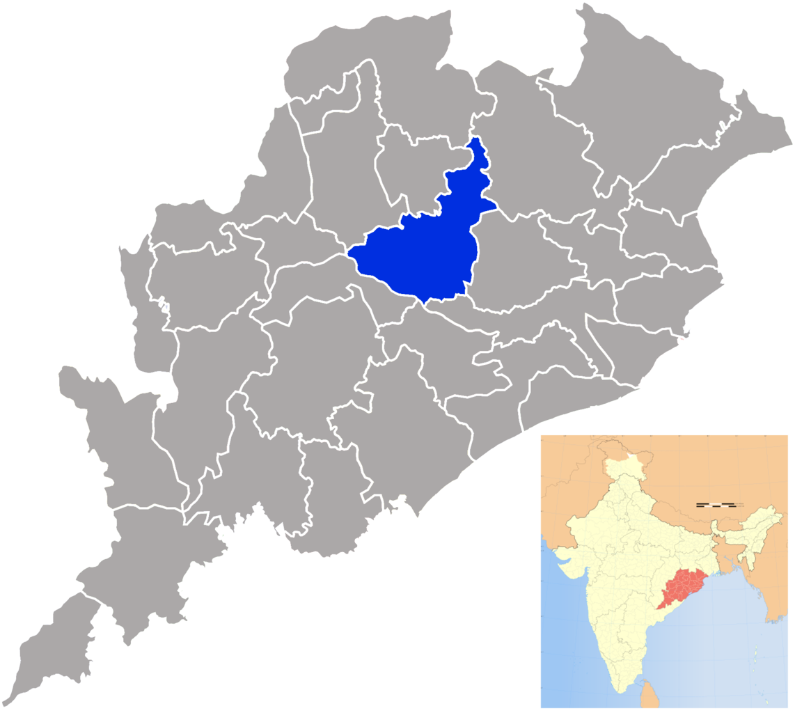
| ᱵᱤᱵᱚᱨᱚᱱᱤ | Angul district in Orissa |
| ᱢᱟᱹᱦᱤᱛ | (UTC) |
| ᱯᱷᱮᱰᱟᱛ | |
| ᱚᱱᱚᱞᱤᱭᱟᱹ |
|
| This is a retouched picture, which means that it has been digitally altered from its original version. The original can be viewed here: Orissa locator map.svg:
|
I, the copyright holder of this work, hereby publish it under the following license:
ᱱᱚᱶᱟ ᱨᱮᱫ ᱫᱚ ᱥᱟᱫᱷᱟᱨᱚᱱ ᱥᱤᱨᱡᱟᱹᱣᱟᱜ Attribution-Share Alike 3.0 Unported ᱞᱟᱭᱥᱮᱸᱥ ᱛᱟᱹᱨᱤᱨᱮ ᱢᱮᱱᱟᱜ-ᱟ ᱾
- ᱟᱲᱟᱜ ᱜᱮᱭᱟᱢ:
- ᱦᱟᱹᱴᱤᱧᱢᱮ – ᱱᱚᱠᱚᱞ ᱞᱟᱹᱜᱤᱫ, ᱦᱟᱹᱴᱤᱧ ᱟᱨ ᱵᱷᱮᱡᱟᱭᱢᱮ ᱠᱟᱹᱢᱤ
- ᱢᱮᱥᱟᱣᱠᱟᱛᱢᱮ – ᱠᱟᱹᱢᱤ ᱟᱞᱜᱟᱭ ᱞᱟᱹᱜᱤᱫ
- ᱞᱟᱛᱟᱨ ᱨᱮᱭᱟᱜ ᱨᱤᱛ ᱞᱮᱠᱟᱛᱮ:
- ᱟᱴᱨᱤᱵᱩᱥᱚᱱ – ᱟᱢ ᱠᱟᱹᱢᱤ ᱥᱚᱫᱚᱨ ᱦᱩᱭᱟᱢᱟ ᱡᱚᱠᱷᱚᱱ ᱚᱱᱚᱞᱤᱭᱟᱹ ᱟᱨᱵᱟᱝ ᱞᱟᱭᱥᱮᱸᱥᱩᱭᱟᱹ ᱫᱟᱨᱟᱭᱛᱮ ᱠᱟᱛᱷᱟ ᱨᱟᱠᱟᱵ ᱠᱷᱟᱱ (ᱢᱮᱱᱠᱷᱟᱱ ᱟᱠᱚ ᱩᱫᱩᱜᱟᱜ ᱦᱚᱨ ᱛᱮᱫᱚ ᱵᱟᱝ ᱡᱟᱦᱟᱸ ᱟᱠᱚᱠᱚ ᱜᱚᱲᱚᱣᱟᱢ ᱟᱨᱵᱟᱝ ᱟᱢᱟᱜ ᱠᱟᱹᱢᱤ ᱨᱮᱱᱟᱜ ᱵᱮᱵᱷᱟᱨ)
- ᱦᱟᱹᱴᱤᱧ ᱱᱚᱝᱠᱟ ᱜᱮ – ᱟᱢ ᱡᱩᱫᱤ ᱠᱟᱹᱢᱤ ᱵᱚᱫᱚᱞ, ᱛᱚᱨᱡᱚᱢᱟ, ᱵᱟᱝᱠᱷᱟᱱ ᱱᱚᱣᱟ ᱠᱟᱹᱢᱤ ᱪᱮᱛᱟᱱᱨᱮ ᱱᱟᱣᱟ ᱠᱟᱹᱢᱤ ᱥᱤᱨᱡᱟᱹᱣᱮᱢ ᱛᱮᱭᱟᱨ ᱠᱷᱟᱱ, ᱛᱚᱵᱮ ᱟᱢ ᱫᱚ ᱚᱱᱟ ᱠᱟᱹᱢᱤ ᱚᱱᱟ ᱢᱤᱫ ᱞᱟᱤᱥᱮᱱᱥ ᱥᱮ ᱚᱱᱟ ᱞᱮᱠᱟᱱᱟᱜ ᱞᱟᱤᱥᱮᱱᱥ ᱨᱮᱜᱮ ᱪᱟᱞ ᱦᱩᱭᱩᱜ ᱛᱟᱢᱟ᱾
Original upload log
This image is a derivative work of the following images:
- File:Orissa_locator_map.svg licensed with Cc-by-sa-3.0
- 2008-09-06T17:28:24Z PlaneMad 2269x2241 (216154 Bytes)
- 2008-02-21T13:28:20Z Mkeranat 647x564 (134867 Bytes) {{Information |Description=Locator map for the state of [w:Orissa] updated to show white borders for districts |Source=self-made, based on India locator map by [w:User:Planemad] |Date=Feb 2008 |Author= Mkeranat |Permission= |
- 2008-02-14T21:32:38Z Mkeranat 647x564 (133465 Bytes) {{Information |Description=Locator map for the state of [w:Orissa] |Source=self-made, based on India locator map by [w:User:Planemad] |Date=Feb 2008 |Author= [[w:User:Mkeranat|Mkeranat]] |Permission= |other_versions= }}
Uploaded with derivativeFX
ᱨᱮᱫ ᱨᱮᱭᱟᱜ ᱱᱟᱜᱟᱢ
ᱚᱠᱛᱚ ᱨᱮ ᱞᱤᱱ ᱢᱮ/ᱚᱠᱛᱚ ᱨᱮ ᱨᱮᱫ ᱧᱮᱞ ᱞᱟᱹᱜᱤᱛ ᱞᱤᱱ ᱢᱮ
| ᱢᱟᱹᱦᱤᱛ/ᱚᱠᱛᱚ | ᱴᱤᱯ | ᱡᱚᱠᱷᱟ | ᱵᱮᱵᱷᱟᱨᱤᱭᱟᱹ | ᱠᱟᱛᱷᱟ | |
|---|---|---|---|---|---|
| ᱱᱤᱛᱚᱜ | ᱒᱑:᱑᱖, ᱒᱔ ᱥᱮᱯᱴᱮᱢᱵᱚᱨ ᱒᱐᱐᱙ | | ᱑,᱘᱒᱓ × ᱑,᱖᱓᱕ (᱔᱕᱐ KB) | Abhijitsathe | {{Information |Description=Angul district in Orissa |Source=*File:Orissa_locator_map.svg |Date=2009-09-24 21:15 (UTC) |Author=*File:Orissa_locator_map.svg: '''PlaneMad''' *derivative work: ~~~ |Permission=see below |other_ver |
ᱯᱷᱟᱭᱤᱞ ᱵᱮᱣᱦᱟᱨ
ᱱᱚᱸᱰᱮ ᱫᱚ ᱟᱨ ᱮᱴᱟᱜ ᱥᱟᱦᱴᱟᱠᱚ ᱵᱟᱱᱩᱜ-ᱟ ᱡᱟᱸᱦᱟᱸ ᱥᱟᱶᱛᱮ ᱱᱤᱭᱟᱹ ᱨᱮᱫ ᱨᱮᱱᱟᱜ ᱡᱚᱱᱚᱲ ᱢᱮᱱᱟᱜ-ᱟ