ᱨᱮᱫ:India West Bengal adm location map.svg

ᱟᱥᱚᱞ ᱨᱮᱫ (SVG ᱨᱮᱫ, ᱱᱚᱨᱢᱟᱞᱛᱮ ᱑,᱐᱓᱙ x ᱑,᱕᱘᱕ pixels, ᱨᱮᱫ ᱡᱟᱜᱟ: ᱓᱕᱐ KB)
ᱢᱩᱬᱩᱛ ᱠᱟᱛᱷᱟ
| ᱵᱤᱵᱚᱨᱚᱱᱤ |
Deutsch: Positionskarte von Westbengalen, Indien
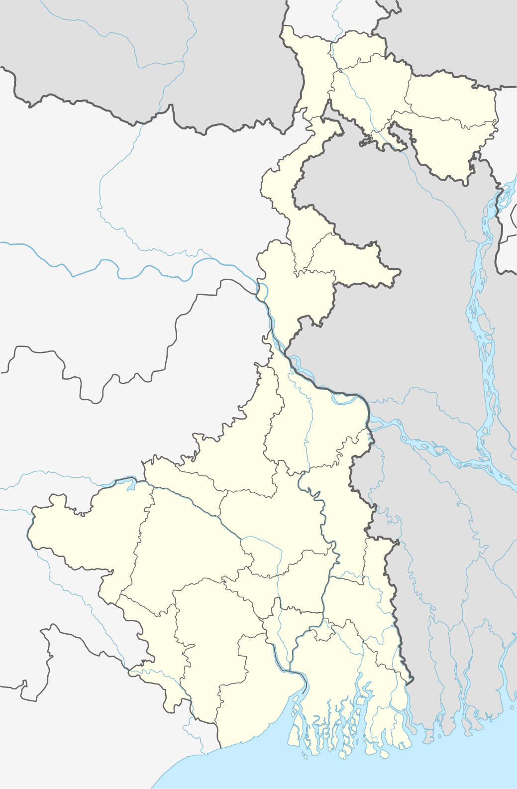
English: Location map of West Bengal, India
|
||||||||||||
| ᱢᱟᱹᱦᱤᱛ | |||||||||||||
| ᱯᱷᱮᱰᱟᱛ |
Own work using:
|
||||||||||||
| ᱚᱱᱚᱞᱤᱭᱟᱹ | NordNordWest | ||||||||||||

|
This map has been made or improved in the German Kartenwerkstatt (Map Lab). You can propose maps to improve as well.
|
ᱞᱟᱭᱥᱮᱱᱥ ᱛᱮᱭᱟᱨ
Usage of this file with:

explanatory notes: Legally binding is only the full legalcode. For a free usage I recommend to respect the following licence conditions:
1. Provide my name as given above: NordNordWest,
2. a copy of, or the URI for, the applicable license: https://creativecommons.org/licenses/by-sa/3.0/de/legalcode,
3. the title of the work,
4. in the case of an adaptation, a credit identifying the use of the work in the adaptation.
This license and the rights granted hereunder will terminate automatically upon any breach by you of the terms of this license. Any of the above conditions can be waived if you get permission from the copyright holder. If you have questions or wish differing conditions, please contact me through nnwest or my discussion page ![]() t-online.de
t-online.de
- ᱟᱲᱟᱜ ᱜᱮᱭᱟᱢ:
- ᱦᱟᱹᱴᱤᱧᱢᱮ – ᱱᱚᱠᱚᱞ ᱞᱟᱹᱜᱤᱫ, ᱦᱟᱹᱴᱤᱧ ᱟᱨ ᱵᱷᱮᱡᱟᱭᱢᱮ ᱠᱟᱹᱢᱤ
- ᱢᱮᱥᱟᱣᱠᱟᱛᱢᱮ – ᱠᱟᱹᱢᱤ ᱟᱞᱜᱟᱭ ᱞᱟᱹᱜᱤᱫ
- ᱞᱟᱛᱟᱨ ᱨᱮᱭᱟᱜ ᱨᱤᱛ ᱞᱮᱠᱟᱛᱮ:
- ᱟᱴᱨᱤᱵᱩᱥᱚᱱ – ᱟᱢ ᱠᱟᱹᱢᱤ ᱥᱚᱫᱚᱨ ᱦᱩᱭᱟᱢᱟ ᱡᱚᱠᱷᱚᱱ ᱚᱱᱚᱞᱤᱭᱟᱹ ᱟᱨᱵᱟᱝ ᱞᱟᱭᱥᱮᱸᱥᱩᱭᱟᱹ ᱫᱟᱨᱟᱭᱛᱮ ᱠᱟᱛᱷᱟ ᱨᱟᱠᱟᱵ ᱠᱷᱟᱱ (ᱢᱮᱱᱠᱷᱟᱱ ᱟᱠᱚ ᱩᱫᱩᱜᱟᱜ ᱦᱚᱨ ᱛᱮᱫᱚ ᱵᱟᱝ ᱡᱟᱦᱟᱸ ᱟᱠᱚᱠᱚ ᱜᱚᱲᱚᱣᱟᱢ ᱟᱨᱵᱟᱝ ᱟᱢᱟᱜ ᱠᱟᱹᱢᱤ ᱨᱮᱱᱟᱜ ᱵᱮᱵᱷᱟᱨ)
- ᱦᱟᱹᱴᱤᱧ ᱱᱚᱝᱠᱟ ᱜᱮ – ᱟᱢ ᱡᱩᱫᱤ ᱠᱟᱹᱢᱤ ᱵᱚᱫᱚᱞ, ᱛᱚᱨᱡᱚᱢᱟ, ᱵᱟᱝᱠᱷᱟᱱ ᱱᱚᱣᱟ ᱠᱟᱹᱢᱤ ᱪᱮᱛᱟᱱᱨᱮ ᱱᱟᱣᱟ ᱠᱟᱹᱢᱤ ᱥᱤᱨᱡᱟᱹᱣᱮᱢ ᱛᱮᱭᱟᱨ ᱠᱷᱟᱱ, ᱛᱚᱵᱮ ᱟᱢ ᱫᱚ ᱚᱱᱟ ᱠᱟᱹᱢᱤ ᱚᱱᱟ ᱢᱤᱫ ᱞᱟᱤᱥᱮᱱᱥ ᱥᱮ ᱚᱱᱟ ᱞᱮᱠᱟᱱᱟᱜ ᱞᱟᱤᱥᱮᱱᱥ ᱨᱮᱜᱮ ᱪᱟᱞ ᱦᱩᱭᱩᱜ ᱛᱟᱢᱟ᱾

ᱨᱮᱫ ᱨᱮᱭᱟᱜ ᱱᱟᱜᱟᱢ
ᱚᱠᱛᱚ ᱨᱮ ᱞᱤᱱ ᱢᱮ/ᱚᱠᱛᱚ ᱨᱮ ᱨᱮᱫ ᱧᱮᱞ ᱞᱟᱹᱜᱤᱛ ᱞᱤᱱ ᱢᱮ
| ᱢᱟᱹᱦᱤᱛ/ᱚᱠᱛᱚ | ᱴᱤᱯ | ᱡᱚᱠᱷᱟ | ᱵᱮᱵᱷᱟᱨᱤᱭᱟᱹ | ᱠᱟᱛᱷᱟ | |
|---|---|---|---|---|---|
| ᱱᱤᱛᱚᱜ | ᱒᱒:᱔᱒, ᱒᱖ ᱮᱯᱨᱤᱞ ᱒᱐᱒᱐ | | ᱑,᱐᱓᱙ × ᱑,᱕᱘᱕ (᱓᱕᱐ KB) | C1MM | Reverted to version as of 08:29, 23 May 2019 (UTC) |
| ᱒᱒:᱔᱑, ᱒᱖ ᱮᱯᱨᱤᱞ ᱒᱐᱒᱐ |  | ᱑,᱐᱓᱙ × ᱑,᱕᱘᱕ (᱓᱖᱒ KB) | C1MM | Changed color of rivers according to French/German location map conventions: color #0978AB | |
| ᱐᱘:᱒᱙, ᱒᱓ ᱢᱮ ᱒᱐᱑᱙ |  | ᱑,᱐᱓᱙ × ᱑,᱕᱘᱕ (᱓᱕᱐ KB) | NordNordWest | upd | |
| ᱑᱑:᱔᱒, ᱖ ᱡᱩᱱ ᱒᱐᱑᱘ |  | ᱑,᱐᱓᱙ × ᱑,᱕᱘᱕ (᱓᱓᱕ KB) | NordNordWest | == {{int:filedesc}} == {{Information |description= {{de|1=Positionskarte von Westbengalen, Indien}} {{en|1=Location map of West Bengal, India}} {{Location map series N |stretching=110 |top=27.4 |bottom=21.3 |left=85.6 |right=90 }} |source={{Own using}} * United States National Imagery and Mapping Agency data * World Data Base II data |date=2018-06-06 |author={{U|NordNordWest}} |permission= |other_versions= }} {{Kartenwerkstatt}} == {{int:license-header}} == {{User:NordNordWest/LicenceMap}} ... |
ᱯᱷᱟᱭᱤᱞ ᱵᱮᱣᱦᱟᱨ
᱑᱐᱐ ᱠᱷᱚᱱ ᱵᱟᱹᱲᱛᱤ ᱥᱟᱦᱴᱟ ᱡᱚᱯᱲᱟᱣ ᱢᱮᱱᱟᱜ-ᱟ ᱱᱚᱣᱟ ᱨᱮᱫ ᱥᱟᱶ ᱾ ᱱᱚᱶᱟ ᱞᱤᱥᱴᱤ ᱩᱫᱩᱜᱮᱜ-ᱟᱭ ᱮᱛᱚᱦᱚᱵ ᱑᱐᱐ ᱥᱟᱦᱴᱟ ᱡᱚᱲᱟᱣᱠᱚ ᱥᱩᱢᱩᱝ ᱱᱚᱶᱟ ᱨᱮᱫ ᱥᱟᱶ ᱾ ᱢᱤᱫ ᱡᱚᱛᱚ ᱞᱤᱥᱴᱤ ᱢᱮᱱᱟᱜ-ᱟ ᱾
- ᱚᱪᱪᱷᱨᱩᱨᱟᱢ ᱢᱮᱢᱳᱨᱤᱭᱟᱞ ᱠᱚᱞᱮᱡᱽ
- ᱛᱚᱢᱞᱩᱠ
- ᱛᱟᱞᱰᱟᱝᱨᱟ
- ᱛᱟᱨᱟᱯᱤᱴᱷ
- ᱛᱩᱯᱷᱟᱱᱜᱚᱧᱡᱽ
- ᱜᱚᱨᱩᱢᱟᱨᱟ ᱡᱟᱹᱛᱤᱭᱟᱹᱨᱤ ᱵᱟᱜᱟᱱ
- ᱜᱚᱵᱷᱚᱨᱢᱮᱱᱴ ᱡᱮᱱᱟᱨᱮᱞ ᱰᱤᱜᱽᱨᱤ ᱠᱚᱞᱮᱡᱽ, ᱢᱟᱱᱵᱟᱡᱟᱨ ᱒
- ᱞᱳᱠᱯᱟᱲᱟ ᱢᱚᱦᱟᱵᱤᱫᱽᱭᱟᱞᱚᱭ
- ᱟᱞᱤᱯᱩᱨ
- ᱟᱞᱤᱯᱩᱨᱫᱩᱣᱟᱨ
- ᱟᱢᱵᱷᱩᱣᱟ
- ᱟᱦᱢᱚᱫᱯᱩᱨ
- ᱟᱱᱚᱱᱫᱚ ᱢᱟᱨᱜᱽ ᱠᱚᱞᱮᱡᱽ
- ᱟᱲᱥᱟ ᱠᱚᱞᱮᱡᱽ
- ᱠᱚᱵᱤ ᱡᱚᱭᱫᱮᱵᱽ ᱢᱚᱦᱟᱵᱤᱫᱽᱭᱟᱞᱚᱭ
- ᱠᱚᱵᱤ ᱱᱚᱡᱽᱨᱩᱞ ᱠᱚᱞᱮᱡᱽ
- ᱠᱟᱞᱤᱜᱷᱟᱴ ᱠᱟᱞᱤ ᱢᱚᱸᱫᱤᱨ
- ᱠᱟᱞᱤᱢᱯᱚᱝ
- ᱠᱟᱥᱤᱯᱩᱨ ᱢᱟᱭᱠᱮᱞ ᱢᱚᱫᱷᱩᱥᱩᱫᱷᱚᱱ ᱢᱚᱦᱟᱵᱤᱫᱽᱭᱟᱞᱚᱭ
- ᱠᱟᱴᱳᱣᱟ
- ᱠᱤᱨᱱᱟᱦᱟᱨ
- ᱠᱨᱤᱥᱱᱚ ᱪᱚᱸᱫᱽᱨᱚ ᱠᱚᱞᱮᱡᱽ
- ᱠᱨᱤᱥᱱᱚᱱᱚᱜᱚᱨ
- ᱠᱩᱪ ᱵᱮᱦᱟᱨ
- ᱠᱳᱴᱥᱤᱞᱟ ᱢᱚᱦᱟᱵᱤᱫᱽᱭᱟᱞᱚᱭ
- ᱠᱷᱚᱲᱚᱜᱽᱯᱩᱨ
- ᱡᱚᱜᱚᱱᱱᱟᱛᱷ ᱠᱤᱥᱚᱨ ᱠᱚᱞᱮᱡᱽ
- ᱡᱚᱞᱯᱟᱭᱜᱩᱲᱤ
- ᱡᱚᱭᱜᱟᱣ
- ᱡᱚᱭᱫᱮᱵᱽ ᱠᱮᱸᱫᱩᱞᱤ
- ᱡᱷᱟᱞᱫᱟ
- ᱡᱷᱟᱲᱜᱨᱟᱢ
- ᱢᱚᱱᱫᱟᱨᱢᱚᱱᱤ
- ᱢᱟᱞᱫᱟ ᱵᱟᱡᱟᱨ
- ᱢᱟᱱᱵᱟᱡᱟᱨ
- ᱢᱩᱨᱟᱨᱚᱭ ᱜᱚᱵᱷᱚᱨᱢᱮᱱᱴ ᱯᱚᱞᱤᱴᱮᱠᱱᱤᱠ
- ᱢᱩᱨᱥᱤᱫᱟᱵᱟᱫᱽ
- ᱢᱮᱫᱤᱱᱤᱯᱩᱨ
- ᱤᱞᱟᱹᱢᱵᱟᱡᱟᱨ
- ᱥᱚᱢᱵᱷᱩᱱᱟᱛᱷ ᱠᱚᱞᱮᱡᱽ
- ᱥᱚᱭᱞᱚᱡᱟᱱᱚᱱᱫᱚ ᱯᱷᱟᱞᱜᱩᱱᱤ ᱥᱢᱨᱤᱛᱤ ᱢᱚᱦᱟᱵᱤᱫᱽᱭᱟᱞᱚᱭ
- ᱥᱟᱱᱛᱤᱱᱤᱠᱮᱛᱚᱱ
- ᱥᱟᱸᱛᱨᱟᱜᱟᱪᱷᱤ
- ᱥᱟᱹᱭᱛᱟᱹ
- ᱥᱤᱞᱤᱜᱩᱲᱤ
- ᱥᱤᱞᱫᱟ ᱪᱚᱸᱫᱽᱨᱚ ᱥᱮᱠᱷᱚᱨ ᱠᱚᱞᱮᱡᱽ
- ᱥᱤᱣᱲᱤ
- ᱥᱤᱭᱩᱲᱤ
- ᱥᱨᱤ ᱨᱟᱢᱠᱨᱤᱥᱱᱚ ᱥᱤᱞᱯᱟ ᱵᱤᱫᱽᱭᱟᱯᱤᱴᱷ
- ᱥᱨᱤᱱᱤᱠᱮᱛᱚᱱ
- ᱥᱩᱨᱩᱞ
- ᱦᱟᱵᱽᱨᱟ
- ᱦᱟᱵᱽᱲᱟ
- ᱦᱤᱨᱟᱞᱟᱞ ᱵᱷᱚᱠᱚᱛ ᱠᱚᱞᱮᱡᱽ
- ᱦᱩᱜᱽᱞᱤ ᱪᱤᱱᱥᱩᱨᱟ
- ᱦᱮᱛᱚᱢᱯᱩᱨ, ᱵᱤᱨᱵᱷᱩᱢ (ᱯᱚᱪᱷᱤᱢ ᱵᱟᱸᱜᱽᱞᱟ)
- ᱨᱚᱵᱤᱱᱫᱽᱨᱚᱱᱟᱛᱷ ᱴᱮᱜᱳᱨ
- ᱨᱟᱡᱽᱱᱚᱜᱚᱨ ᱢᱚᱦᱟᱵᱤᱫᱽᱭᱟᱞᱚᱭ
- ᱨᱟᱢᱯᱩᱨᱦᱟᱴ
- ᱨᱟᱢᱯᱩᱨᱦᱟᱴ ᱜᱚᱵᱷᱚᱨᱢᱮᱱᱴ ᱯᱚᱞᱤᱴᱮᱠᱱᱤᱠ
- ᱨᱟᱢᱯᱩᱨᱦᱟᱴ ᱠᱚᱞᱮᱡᱽ
- ᱨᱟᱢᱯᱩᱨᱦᱟᱴ ᱪᱟᱸᱜᱟ ᱠᱷᱚᱸᱰ
- ᱨᱟᱭᱜᱚᱸᱡᱽ
- ᱨᱟᱭᱯᱩᱨ, ᱵᱤᱨᱵᱷᱩᱢ (ᱯᱚᱪᱷᱤᱢ ᱵᱟᱸᱜᱽᱞᱟ)
- ᱨᱟᱱᱟᱜᱷᱟᱴ
- ᱪᱚᱱᱰᱤᱫᱟᱥ ᱢᱚᱦᱟᱵᱤᱫᱽᱫᱟᱞᱚᱭ
- ᱪᱤᱛᱛᱚ ᱢᱟᱦᱟᱛᱳ ᱢᱮᱢᱳᱨᱤᱭᱟᱞ ᱠᱚᱞᱮᱡᱽ
- ᱫᱟᱨᱡᱤᱞᱤᱝ
- ᱫᱤᱜᱷᱟ
- ᱫᱤᱱᱦᱟᱴᱟ
- ᱫᱩᱨᱜᱟᱯᱩᱨ
- ᱫᱩᱵᱽᱨᱟᱡᱽᱯᱩᱨ
- ᱫᱷᱩᱞᱤᱭᱟᱱ
- ᱯᱟᱱᱟᱜᱚᱲ
- ᱯᱩᱨᱩᱞᱤᱭᱟᱹ
- ᱯᱷᱟᱨᱟᱠᱠᱟ
- ᱱᱚᱞᱦᱟᱴᱤ
- ᱱᱚᱞᱦᱟᱴᱤ ᱜᱚᱵᱷᱚᱨᱢᱮᱱᱴ ᱯᱚᱞᱤᱴᱮᱠᱱᱤᱠ
- ᱱᱟᱱᱩᱨ
- ᱱᱮᱛᱟᱡᱤ ᱥᱩᱵᱷᱟᱥ ᱪᱚᱸᱫᱽᱨᱚ ᱵᱳᱥ ᱡᱮᱡᱟᱹᱛᱤᱭᱟᱹᱨᱤ ᱩᱰᱟᱹᱱ ᱰᱟᱹᱦᱤ
- ᱵᱚᱞᱚᱨᱟᱢᱯᱩᱨ ᱠᱚᱞᱮᱡᱽ
- ᱵᱚᱦᱚᱨᱚᱢᱯᱩᱨ
- ᱵᱚᱨᱟᱵᱟᱡᱟᱨ ᱵᱤᱠᱨᱚᱢ ᱴᱩᱰᱩ ᱢᱮᱢᱳᱨᱤᱭᱟᱞ ᱠᱚᱞᱮᱡᱽ
- ᱵᱚᱨᱩᱣᱟ ᱜᱳᱯᱟᱞᱯᱩᱨ
- ᱵᱚᱨᱫᱷᱚᱢᱟᱱ
- ᱵᱟᱜᱽᱰᱚᱜᱽᱨᱟ
- ᱵᱟᱞᱩᱨᱜᱷᱟᱴ
- ᱵᱟᱱᱫᱳᱣᱟᱱ ᱢᱚᱦᱟᱵᱤᱫᱽᱭᱟᱞᱚᱭ
- ᱵᱟᱸᱠᱩᱲᱟ
- ᱵᱤᱠᱨᱚᱢᱡᱤᱛ ᱜᱳᱥᱣᱟᱢᱤ ᱢᱮᱢᱳᱨᱤᱭᱟᱞ ᱠᱚᱞᱮᱡᱽ
- ᱵᱤᱥᱱᱩᱯᱩᱨ, ᱵᱟᱸᱠᱩᱲᱟ
- ᱵᱤᱨᱵᱷᱩᱢ ᱢᱚᱦᱟᱵᱤᱫᱽᱭᱟᱞᱚᱭ
- ᱵᱤᱨᱵᱷᱩᱢ ᱤᱱᱥᱴᱤᱴᱤᱭᱩᱰ ᱚᱯᱷ ᱤᱧᱡᱤᱱᱤᱭᱚᱨᱤᱝ ᱟᱨ ᱴᱮᱠᱱᱚᱞᱚᱡᱤ
- ᱵᱤᱱᱩᱨᱤᱭᱟᱹ
- ᱵᱮᱝᱜᱚᱞ ᱞᱚ ᱠᱚᱞᱮᱡᱽ
- ᱵᱮᱝᱜᱚᱞ ᱤᱱᱥᱴᱤᱴᱤᱭᱩᱰ ᱚᱯᱷ ᱴᱮᱠᱱᱚᱞᱚᱡᱤ ᱟᱨ ᱢᱮᱱᱮᱡᱽᱢᱮᱱᱴ
- ᱵᱳᱞᱯᱩᱨ
- ᱵᱳᱞᱯᱩᱨ-ᱥᱨᱤᱱᱤᱠᱮᱛᱚᱱ ᱵᱚᱱᱚᱛ
- ᱜᱟᱞᱢᱟᱨᱟᱣ:ᱱᱮᱛᱟᱡᱤ ᱥᱩᱵᱷᱟᱥ ᱪᱚᱸᱫᱽᱨᱚ ᱵᱳᱥ ᱡᱮᱡᱟᱹᱛᱤᱭᱟᱹᱨᱤ ᱩᱰᱟᱹᱱ ᱰᱟᱹᱦᱤ
- ᱪᱷᱟᱸᱪ:Location map India West Bengal
View more links to this file.
ᱡᱮᱜᱮᱛ ᱡᱟᱠᱟᱛ ᱨᱮᱫ ᱵᱮᱵᱷᱟᱨᱟᱜ
ᱱᱚᱶᱟ ᱨᱮᱫᱠᱚ ᱵᱮᱵᱷᱟᱨᱟᱠᱟᱫ ᱣᱤᱠᱤᱠᱚ :
- ar.wikipedia.org ᱨᱮ ᱵᱮᱣᱦᱟᱨ
- as.wikipedia.org ᱨᱮ ᱵᱮᱣᱦᱟᱨ
- azb.wikipedia.org ᱨᱮ ᱵᱮᱣᱦᱟᱨ
- کلکته
- تونقلو, باتی بنقال
- سانکاری, باتی بنقال
- روهینی, باتی بنقال
- پانچکولا (باتی بنقال )
- کوارا, باتی بنقال
- کاشیپور, باتی بنقال
- دبیپور, باتی بنقال
- پیاسالا
- فوتیقودا
- فولکوسما
- ساتاری, مالدا
- ساتپالسا
- ساتکول
- ساتبانکورا
- سارماستر چاک
- ساریشا
- سارنقا, بانکورا
- ساربریا
- سانتوری, پورولیا
- مایورهات
- مایورسوار
- مایدا, جایناقار
- مایاهاوری
- سانکرایل, جارقرام
- سانکار پارولیا
- سانقرامپور, ماقراهات
- ماتکاتپور
- کالیناقار, جایناقار
- کالیقرام
- ماسینا, پورولیا
- کالاپاتار
- سامودراقاره
- ماساقرام
- سامتا, ایندیا
- سامسی, مالدا
- ماروادیه
- کالابریا
ᱱᱚᱶᱟ ᱨᱮᱫ ᱨᱮᱱᱟᱜ ᱵᱟᱹᱲᱛᱤ ᱡᱮᱜᱮᱛ ᱵᱮᱵᱷᱟᱨ ᱧᱮᱞ ᱢᱮ ᱾